Coastal Resilience Project Secures Nearly $1 Million to Restore Wetlands

Degraded marsh on Cumberland Island, Georgia.

Degraded marsh on Cumberland Island, Georgia.

The National Fish and Wildlife Foundation (NFWF) has awarded an interdisciplinary team nearly $1 million in funding through the National Coastal Resilience Fund to restore coastal wetlands in Georgia. It was the only project in Georgia to be selected for funding from the program's 2025 call for proposals.

The award will support the design of nature-based solutions including living shorelines and marsh restoration in flood-prone areas of Camden County, Georgia, adjacent to Naval Submarine Base Kings Bay, Cumberland Island National Seashore, and the city of St. Marys. 

“Restoring wetlands in Camden County is not just an environmental priority — it’s a resilience strategy for the entire region,” says principal investigator (PI) Joel Kostka, Tom and Marie Patton Distinguished Professor, associate chair for Research in the School of Biological Sciences, and faculty director of Georgia Tech for Georgia’s Tomorrow. “Each acre of restored marshland protects coastal communities from natural hazards like storms and flooding, provides essential marine habitat, and has the potential to aid the Navy and the Army Corps of Engineers in developing management alternatives for dredged materials. When our wetlands flourish, our whole coastline does.”

In addition to Kostka, co-PI’s include University of Georgia (UGA) Skidaway Institute of Oceanography Director Clark Alexander, UGA Associate Professor Matt Bilskie and Professor Brian BledsoeThe Nature Conservancy Coastal Climate Adaptation Director Ashby Worley, and Georgia Tech alumnus Nolan Williams of Robinson Design Engineers, a firm dedicated to the engineering of natural infrastructure in the Southeast that is owned and operated by Georgia Tech alumnus Joshua Robinson.

A coastal collaboration

The new project, known as a “pipeline project” by NFWF,  builds on multiple resilience plans and years of previous research conducted by the established team. “This is a testament to the value of the long-term collaborations and partnerships that enable coastal resilience work,” Kostka says. “We’re working closely with local communities and a range of city, state, and federal stakeholders to ensure these solutions align with local priorities and protect what matters most.”

It’s not the first time that the team has brought this type of collaboration to the coastline. Since 2019, Kostka has worked alongside the South Carolina Department of Natural Resources, the South Carolina Aquarium, and Robinson Design Engineers in a $2.6 million effort to restore degraded salt marshes in historic Charleston, also funded by NFWF. Now in the implementation phase, much of the marsh restoration in Charleston involves planting salt-tolerant grasses, restoring oyster reefs, and excavating new tidal creeks — work that is being spearheaded by local volunteers.

“Coastal resilience isn’t something one group can tackle alone,” Kostka adds. “That shared, community-driven vision is what makes these projects possible.”

Kostka sampling transects of marshland on Cumberland Island, Georgia.

Kostka sampling transects of marshland on Cumberland Island, Georgia.

Erosion around the historic property “Dungeness” on Cumberland Island, Georgia.

Erosion around the historic property “Dungeness” on Cumberland Island, Georgia.

Flooding in the town of St. Marys, a town in Camden County, Georgia.

Flooding in the town of St. Marys, a town in Camden County, Georgia.

 
News Contact

Written by Selena Langner

A 30-Year “Snapshot” of Pacific Northwestern Birds Shows Their Surprising Resilience

The Canada Jay is one of the birds struggling in the Pacific Northwest. (Credit: Mason Maron)

The Canada Jay is one of the birds struggling in the Pacific Northwest. (Credit: Mason Maron)

A 30-year “snapshot study” of birds in the Pacific Northwest is showing their surprising resilience in the face of climate change. The project started when School of Biological Sciences Assistant Professor Benjamin Freeman found a study by Louise Waterhouse detailing birds in the mountains near Vancouver three decades ago. What followed was an ecological scavenger hunt: Freeman revisited each of the old field sites, navigating using his local knowledge and Waterhouse’s hand-drawn maps.

Freeman, who grew up in Seattle, mainly studies the ecology of tropical birds — but the discovery of Waterhouse’s paper made him curious about research closer to home. The results were surprising: over the last three decades, most of the bird populations in the region were stable and had been increasing in abundance at higher elevations.

The study, “Pacific Northwest birds have shifted their abundances upslope in response to 30 years of warming temperatures” was published in the journal Ecology this fall. In addition to lead author Freeman, the team also included Harold Eyster (The Nature Conservancy), Julian Heavyside (University of British Columbia), Daniel Yip (Canadian Wildlife Service), Monica Mather (British Columbia Ministry of Water, Lands and Resource Stewardship), and Waterhouse (British Columbia Ministry of Forests, Coast Area Research).

“It is great news that most birds in the region are resilient, and by doing this work, we can focus on the species that do need help, like the Canada Jay, which is struggling in this region,” Freeman says. “Studies like this help us focus resources and effort.”

Songbirds and snow

Conducting the fieldwork was a detective game, Freeman says. Each day, he would wake up at four in the morning to locate and visit the research areas — often navigating trails, open forest, and rough terrain on foot.

This area of the Pacific Northwest is punctuated with old-growth stands of trees — sections of forest that have never been logged or altered. “These areas feel like islands,” Freeman shares. “They feel ancient and untouched, but even in pristine habitats, birds are still responding to climate change.”

Most of the work was conducted during the birds’ breeding season, from late May into June. This is when the birds are most vocal, which is ideal for surveys, Freeman says. The downside? Even in June, there is often snow in the mountains. “I was out at dawn, hiking through snow in the freezing cold, wondering why I didn’t stay in bed,” he recalls. “But then I’d hear birds singing all around me and realize it was all worth it.”

Upward expansion — and resilience

By comparing the two “snapshots,” the team showed that while temperatures have increased over the last 30 years, most bird populations in the region haven’t declined — but they have become more abundant at higher elevations. “It’s encouraging,” Freeman says. “Thirty years of warming has led to changes, but for the most part, these bird populations are mostly stable or improving.”

One reason for this resilience could be the stability that old growth forests provide, and Freeman suggests that conserving wide swaths of mountain habitat might help birds thrive as they continue to adapt, while still supporting populations at lower elevations. The study also helps identify which bird species need additional support, like the Canada Jay — a gray and white bird known for following hikers in pursuit of dropped snacks.

It’s just one piece of Freeman’s larger research goal — he aims to do this type of snapshot research in many different places to identify general patterns, especially differences in temperate versus tropical environments.

“In the tropics, most bird species are vulnerable, with only a few resilient species. In the Pacific Northwest, we saw the opposite,” he says. “A pattern is emerging: temperate zones show more resilience, tropics more vulnerability.” 

Freeman is also conducting research with a group of students in Northern Georgia. “We predict that these Appalachian birds will be resilient as well,” he says, “but we need to study and understand what’s happening in nature — not just make predictions.”


DOI: https://doi.org/10.1002/ecy.70193

Funding: Packard Foundation

A placard still standing from the original surveys conducted in the early 90's. Finding these original sites was a "scavenger hunt," Freeman says. (Credit: Benjamin Freeman)

A placard still standing from the original surveys conducted in the early 90's. Finding these original sites was a "scavenger hunt," Freeman says. (Credit: Benjamin Freeman)

A large downed cedar tree in one of the lowland old-growth forests that Freeman navigated. (Credit: Benjamin Freeman)

A large downed cedar tree in one of the lowland old-growth forests that Freeman navigated. (Credit: Benjamin Freeman)

Townsend's Warbler, a small songbird that lives in the forests of the Pacific Northwest. (Credit: Melissa Hafting, @bcbirdergirl)

Townsend's Warbler, a small songbird that lives in the forests of the Pacific Northwest. (Credit: Melissa Hafting, @bcbirdergirl)

While locating the field sites, Freeman spotted this bear on an old road. (Credit: Benjamin Freeman)

While locating the field sites, Freeman spotted this bear on an old road. (Credit: Benjamin Freeman)

An overgrown and abandoned road that Freeman traversed. (Credit: Benjamin Freeman)

An overgrown and abandoned road that Freeman traversed. (Credit: Benjamin Freeman)

The Varied Thrush is another bird common in the Pacific Northwest. (Credit: Melissa Hafting, @bcbirdergirl)

The Varied Thrush is another bird common in the Pacific Northwest. (Credit: Melissa Hafting, @bcbirdergirl)

 
News Contact

Written by Selena Langner

Mapping Evolution: James Stroud Named 2025 Packard Fellow

Although the sensors weigh just three-hundredths of a gram each — the same as a single grain of rice — when combined with innovations in mapping technology, they will help Stroud observe the lizards as active participants in their species’ evolution.

Although the sensors weigh just three-hundredths of a gram each — the same as a single grain of rice — when combined with innovations in mapping technology, they will help Stroud observe the lizards as active participants in their species’ evolution.

James Stroud has been named a 2025 Packard Fellow for his pioneering research in evolutionary biology. Stroud, Elizabeth Smithgall-Watts Early Career Assistant Professor in the School of Biological Sciences, will receive $875,000 over five years to fund his work on “Lizard Island” in South Florida. His goal? To create evolution’s first high-definition map — with the help of 1,000 backpack-wearing lizards.

Awarded annually to just 20 individuals by the David and Lucile Packard Foundation, Packard Fellowships for Science and Engineering support researchers pursuing cutting-edge research and ambitious goals. “These visionary Packard Fellows are pushing the boundaries of knowledge, and their bold ideas will become tomorrow’s real-world solutions,” says Nancy Lindborg, president and CEO of the Packard Foundation in a recent press release.

The flexible funding allows researchers to maximize their creativity and ingenuity. Stroud will spend the next five years transforming Lizard Island into the world’s premier evolutionary observatory, merging groundbreaking technology with long-term field research.

On Lizard Island, that means equipping every lizard with an ultra-lightweight sensor “backpack.” Although the sensors weigh just six-hundredths of a gram each — the same as two grains of rice — when combined with innovations in mapping technology, they will help Stroud investigate the role that behavior plays in driving evolution in the wild.

“I’m incredibly honored to be named a 2025 Packard Fellow,” says Stroud. “This support allows me to pursue a question that has fascinated evolutionary biologists for centuries: how does behavior shape evolution? It’s a transformative opportunity, and I’m deeply grateful to the Packard Foundation for believing in the potential of this work.”

Tiny sensors, big questions

Begun in 2015, Stroud’s work on Lizard Island is one of the longest-running evolutionary studies of its kind: for the last 10 years, he has carefully caught and released every lizard on the island, measuring evolution through documenting their body characteristics, habitat use, and survival.

Through his studies, he has captured evolution in action, but monitoring and measuring behavior in evolutionary studies has historically been an extremely difficult and elusive task. The problem? While smaller animals tend to have higher population densities and reproduce more quickly (making them ideal candidates for evolutionary field studies), it has been difficult to find durable and long-lasting sensors small enough for these animals to carry.

“This has been a missing link because behavior is a critical component of evolution,” Stroud says. “Behavior can both expose individuals to — or shield them from — natural selection. For example, an animal with a less favorable trait, like bad eyesight, could change its behavior to avoid situations where it is disadvantaged. 

“These decisions can ultimately determine whether they survive and reproduce in the wild, directly influencing the outcome of natural selection. However, until now, we just haven’t had the technology to measure these types of extremely intricate behaviors across many individuals before.”

Mapping the future

Stroud won’t just know exactly where each lizard is — he’ll also create a detailed three-dimensional map of the entire island using remote sensing technology called LiDAR, updating it each year. “By shooting millions of laser beams, we can create a highly detailed three-dimensional map of Lizard Island, capturing the shape of every branch, rock, and blade of grass on the island,” he explains. “When connected to our lizard backpacks, we’ll know the exact microhabitats and resources available to each lizard as they move through this environment.”

Stroud will also deploy hundreds of microclimate sensors to understand how species are reacting to changes in temperature and climate. The result will be the world’s first comprehensive database: a record of minute lizard movements, the resources each individual uses, daily interactions, and changes in the environment spanning seasons and years. 

“For evolutionary scientists, it has been seemingly impossible to track the moment-by-moment decisions of individual organisms… until now,” he says.

“Today, it’s possible to study what Darwin could only dream of — evolution occurring in real time,” Stroud adds. “Behavior is a critical component of evolution, understanding evolution is critical to understanding life on Earth, and understanding life on Earth is more important than ever.”

Stroud will spend the next five years transforming Lizard Island into the world’s premier evolutionary observatory, merging groundbreaking technology with long-term field research.

Stroud will spend the next five years transforming Lizard Island into the world’s premier evolutionary observatory, merging groundbreaking technology with long-term field research.

James Stroud examines a lizard in the field. (Day’s Edge Productions)

James Stroud examines a lizard in the field. (Day’s Edge Productions)

 
News Contact

Written by Selena Langner

Fixing Flooding for the Southeast’s Future

Post-hurricane flooding inundates residential areas and transportation infrastructure, with low-lying terrain overwhelmed by storm surge and excessive rainfall.

Flooding dominated the headlines of summer 2025. Atypical storms and rising rivers in the Texas Hill Country washed away an entire summer camp. Glacial snow melt, combined with flash river floods, caused hundreds of deaths in Pakistan. As the Atlantic hurricane season hits its peak, Americans wait to see if another storm may be as unexpectedly devastating as 2024’s Hurricane Helene

Flooding can be an existential threat, affecting everything from infrastructure to health. Georgia Tech researchers are developing solutions to monitor and forecast flooding, as well as restore ecosystems to prevent future flooding. These efforts support communities’ resilience in the face of climate change and keep the U.S. secure.

Read more »


The Future of Antarctic Ice: New Study Reveals the Mathematics of Meltwater Lakes

A view of Greenland's ice sheet from the NASA/USGS Landsat 8 satellite showing meltwater lakes on a glacier. (Credit: NASA)

A view of Greenland's ice sheet from the NASA/USGS Landsat 8 satellite showing meltwater lakes on a glacier. (Credit: NASA)

Georgia Tech researchers have developed a mathematical formula to predict the size of lakes that form on melting ice sheets — discovering their depth and span are linked to the topography of the ice sheet itself. 

The team leveraged physics, model simulations, and satellite imagery to develop simple mathematical equations that can easily be integrated into existing climate models. It’s a first-of-it’s-kind tool that is already improving climate models.

“Melt lakes play an important role in ice sheet stability, but previously, there were no constraints on what we would expect their maximum size to be in Antarctica,” says study lead Danielle Grau, a Ph.D. student in the School of Earth and Atmospheric Sciences. “I was intrigued by the idea of quantifying how much of a role we could expect them to play in the future.”

The paper, “Predicting mean depth and area fraction of Antarctic supraglacial melt lakes with physics-based parameterizations,” was published in Nature Communications. In addition to Grau, the research team includes School of Earth and Atmospheric Sciences Professor Alexander Robel, who is Grau’s advisor, and Azeez Hussain (PHYS 2025).

Their predictions show that the majority of these lakes will be less than a meter deep and span up to 40% of the ice sheet surface area.

“Many models don’t include any data about lakes on the surface of ice sheets, while others simulate these melt lakes growing until the ice collapses,” Robel says. “Our results show that the reality is somewhere in between — and that the maximum size of these lakes can be predicted using these new equations. This gives us real, concrete numbers to use in climate models.”

From summer project to satellite discovery 

Grau first started working on the project as an undergraduate student when she applied for a Summer Research Experiences for Undergraduates program hosted by the School of Earth and Atmospheric Sciences.

Inspired by terrestrial lake research, Grau and Robel investigated the “self-affinity” of the Antarctic ice sheet — a property associated with surface roughness across various scales. For example, a landscape like Badlands National Park, with many rolling hills of a wide range of sizes, would have a different self-affinity than a flat prairie with three large volcanoes.

“A previous study had used this property to predict the size of terrestrial lakes and ponds, and we were curious if we could use a similar approach for supraglacial lakes in Antarctica,” Grau says. “Establishing that the Antarctic ice sheet also has this property was the first step in pursuing this research in more depth.” 

The mathematics of melt

Grau continued the investigation as a Ph.D. student in Robel’s lab. Together, they unraveled the physics of how meltwater moves across the ice surface, designing a ‘glacier in a computer’ that mimics meltwater accumulation and movement across various topographies.

“We designed an algorithm and integrated it into a model that the GT Ice & Climate Group has used in the past,” Grau says. “From that, we were able to see how lakes would form on different surfaces across thousands of scenarios. This was the foundation for the mathematical equations I developed, which can predict the lake depth and lake surface area based on the self-affinity property.”

To check their results, Grau enlisted the help of Hussain — then an undergraduate in the School of Physics — to examine satellite data from the Landsat satellite program (which captures detailed photography of the Earth’s surface from space) to measure existing supraglacial lakes and surface topography. 

“It was exciting to see how our predictions lined up with what we were seeing in the satellite imagery,” Robel explains. “This shows that our solution is a concrete avenue for climate models to realistically incorporate supraglacial lakes.”

Grau is already working to incorporate the team’s equations into an atmospheric model used by NASA in addition to an ice sheet model developed by the NASA Jet Propulsion Laboratory and Dartmouth College. 

“By turning complicated models and satellite data into simple predictive equations, we’re giving climate models a new lens to see the future,” she says. “It’s a small piece of the puzzle,  but one that helps us understand how ice sheets respond to a warming world.”


Funding: NASA Modeling, Analysis, and Prediction Program

DOI: https://doi.org/10.1038/s41467-025-61798-8 

 
News Contact

Written by Selena Langner

Decades in the Making: Seeing the Full Impact From Air Pollution Reductions

NOAA Iridescent Clouds

Iridescent clouds before sunset / Source: NOAA
 

Researchers at Georgia Tech have analyzed the seasonal differences of sulfate aerosols — a major pollutant in the United States — to examine the long-term impact from sulfur dioxide (SO₂) emission reductions since the enactment of the Clean Air Act amendments in 1990. 

School of Earth and Atmospheric Sciences Professor Yuhang Wang and his team studied the factors affecting SO₂ and sulfate concentrations during winter and summer in the “Rust Belt” — from New York through the Midwest — and the Southeast regions of the U.S. over two decades (2004 to 2023). Supported by the National Science Foundation and Georgia Tech’s Brook Byers Institute for Sustainable Systems, the team also developed an ensemble machine learning approach to project seasonal patterns until 2050. 

“Power plants, particularly those burning coal and oil, are a major source of SO₂ emissions in these regions,” says Wang, who co-authored, with Ph.D. students Fanghe Zhao and Shengjun Xi, the study recently published in Environmental Science & Technology Letters

Seasonal differences in atmospheric chemistry 

In the U.S., the chemistry in the atmosphere varies among the seasons. During summer, solar radiation from ample sunlight activates oxidant reactions that produce hydrogen peroxide (HO) in the atmosphere. The supply of HO is determined by the amount of emitted air pollution, and once in the atmosphere, HO can oxidize SO₂ quickly into sulfate aerosols in the aqueous phase. 

Sulfate aerosols from the oxidation of SO₂ contribute to the formation of particulate matter less than 2.5 micrometers in diameter (PM2.5). Particulate sulfate poses significant environmental and public health risks, including air pollution, acid rain, and circulatory and respiratory issues. 

“The supply of HO in summer is eight times greater than in winter — a huge difference — which means sulfate concentrations are generally higher in summer and a reduction in SO₂ emissions leads to a proportional decrease in sulfate concentrations,” explains Wang. “When SO₂ emissions exceed the available supply of HO in winter, the reduction in sulfate concentrations can be much smaller because of a ‘chemical damping’ effect that causes sulfate levels to decline more slowly than SO₂ emissions.” 

Narrowing the disparities between seasonal sulfate levels 

The study’s two-decade observations revealed distinct patterns in the reduction of SO₂ emissions and sulfate concentrations during winter and summer. 

While SO₂ emissions significantly decreased in both seasons­ over time — primarily from the Clean Air Act and more power plants transitioning from coal to natural gas — the reduction of sulfate concentrations initially showed large seasonal differences. However, over the past decade, the disparity between winter and summer sulfate levels narrowed as SO₂ emissions decreased.

According to Wang, the seasonal disparity of sulfate was caused by changing chemical regimes in winter over time. Although the lower supply of HO remained stable in winter, SO₂ wintertime emissions were higher from 2004 to 2013, then dropped below the level of HO after 2013 — reaching parity with the levels of reduced SO₂ emissions in the summer. 

“When you have this complexity of atmospheric chemistry, there is a non-linear effect in winter — as SO₂ emissions decreased, sulfate aerosol production efficiency increased until 2013, then flattened as of today. The reduction in sulfate aerosols initially lagged behind the decrease in SO₂ emissions but eventually caught up as a result of sustained air quality control efforts,” says Wang. “Conversely, there is a simple, linear effect in summer — the more SO₂ emissions, the more sulfate aerosols in the atmosphere — and if you reduce one, the other is reduced by the same proportion.”

Decades-long full impact 

From now until 2050, the researchers’ machine learning projections indicate a continuing decrease of winter and summer sulfate levels, which are currently around 20 percent, as SO₂ emission controls achieve comparable efficacy across the seasons. 

“We’re now seeing the full impact from the Clean Air Act,” concludes Wang, “and the nation’s sustained effort in pollution reduction is key to improving air quality and health outcomes.”

Yuhang Wang

School of Earth and Atmospheric Sciences Professor Yuhang Wang and his team co-authored the study, “Chemically Induced Decline in Wintertime SO Emission Control Efficacy,” which was published in Environmental Science & Technology Letters.


Fanghe Zhao

Ph.D. student Fanghe Zhao

Shengjun Xi
Ph.D. student Shengjun Xi
 
News Contact

Jess Hunt-Ralston
Director of Communications
College of Sciences at Georgia Tech

Writer: Annette Filliat

Editor: Lindsay Vidal 

Meet the Microbes: What a Warming Wetland Reveals About Earth’s Carbon Future

An arial photo of the SPRUCE experiment.

An arial photo of the SPRUCE experiment.

Between a third and half of all soil carbon on Earth is stored in peatlands, says Tom and Marie Patton Distinguished Professor Joel Kostka. These wetlands — formed from layers and layers of decaying plant matter — span from the Arctic to the tropics, supporting biodiversity and regulating global climate.

“Peatlands are essential carbon stores, but as temperatures warm, this carbon is in danger of being released as carbon dioxide and methane,” says Kostka, who is also the associate chair for Research in the School of Biological Sciences and the director of Georgia Tech for Georgia’s Tomorrow. Understanding the ratio of carbon dioxide to methane is critical, he adds, because while both are greenhouse gasses, methane is significantly more potent.

Kostka is the corresponding author of a new study unearthing how and why peatlands are producing carbon dioxide and methane. 

The research, “Northern peatland microbial communities exhibit resistance to warming and acquire electron acceptors from soil organic matter,” was published this summer in Nature Communications, and was led by co-first authors Borja Aldeguer-Riquelme, a postdoctoral research associate in the Environmental Microbial Genomics Laboratory, and Katherine Duchesneau, a Ph.D. student in the School of Biological Sciences.

The study builds on a decade of research at the Oak Ridge National Lab’s Spruce and Peatland Responses Under Changing Environments (SPRUCE) experiment, a long-term research project in Minnesota that allows researchers to warm whole sections of wetland from tree top to bog bottom.

“Over the past 10 years, we’ve shown that warming in this large-scale climate experiment increases greenhouse gas production,” Kostka says. “But while warming makes the bog produce more methane, we still observe a lot more CO2 production than methane. In this paper, we take a critical step towards discovering why — and describing the mechanisms that determine which gases are released and in what amounts.”

Methane mystery

The subdued methane production in peatlands has been a long-standing mystery. In water-saturated wetlands, oxygen is scarce, but microbes still need to respire — a type of ‘breathing’ that allows them to produce energy for metabolic function. Without oxygen, microbes use nitrate, sulfate, or metals to respire — still releasing carbon dioxide in the process. However, if these ingredients aren’t present, microbes ‘breathe’ in a way that releases methane.

Since nitrate, sulfate, and metals are relatively rare in peatlands, methane production should be the most likely pathway, but surprisingly, observations show the opposite. “In both fieldwork and lab experiments, peatlands produce much more carbon dioxide than methane,” Kostka explains. “It’s puzzling because the soil conditions should help methane production dominate.”

To solve this mystery, the team leveraged a suite of cutting-edge genetic tools called “omics” —  metagenomics (studying DNA), metatranscriptomics (studying RNA), and metabolomics (a technique used to study the “leftovers” of metabolism), providing a detailed look under the hood of the microbial “engine” that cycles organic matter in wetlands. It also gave a new window into the diversity of soil microbes in wetlands: 80 percent of the organisms identified in the study were new at the genus level.

‘Omics’ innovations

Over the course of several years, the team collected samples from a peatland enclosed in an experimental chamber that was slowly warmed, then analyzed the samples using omics to see how they changed. Initially, they hypothesized that warming the soil would cause microbial communities to change quickly. “Microbes can evolve and grow rapidly,” Kostka says. “But that didn’t happen.”

The DNA-based methods showed that while the microbial communities stayed largely stable, the bog did release more greenhouse gasses as it warmed. To assess the metabolic potential of the microbes, Duchesneau and Aldeguer-Riquelme constructed microbial genomes, investigating how they were decomposing the organic matter in peatlands and cycling carbon.

“We found that microbial activity increases with warming, but the growth response of microbial communities lags behind these changes in physiological or metabolic activity,” Kostka says. He cautions that this doesn’t necessarily mean that wetland communities won’t change as climates warm — just that these shifts might come behind metabolic ones. 

A diversity of discoveries

And the methane? The team believes that microbes may be breaking down organic matter to access the key ingredients for producing carbon dioxide — nitrate, sulfate, and metals — though more research is currently underway to investigate this.

“Doing this type of integrated omics research in soil systems is still incredibly difficult,” Kostka says. The challenge is multifaceted: the research leverages years of experiments, long-term datasets, advanced laboratory techniques, and fieldwork innovations. 

At SPRUCE, experimental chambers are about 1,000 square feet. While it’s an impressive experimental setup, researchers still must be careful: “We need to take soil samples for many years, so if we take too many, there’d be no soil left!” Kostka explains. “Part of our research involves developing better, non-destructive sampling techniques.”

The other challenge lies in what makes these peatlands so unique: it’s very hard to detect small changes because of the sheer diversity of organisms present. “Every time we conduct this type of research, we learn more about these incredible systems,” he says. “There’s always something new.”

Postdoctoral Researchers Caitlin Petro and Borja Aldeguer-Riquelme inside a SPRUCE chamber in 2023.

Postdoctoral Researchers Caitlin Petro and Borja Aldeguer-Riquelme inside a SPRUCE chamber in 2023.

Ph.D. student Katherine Duchesneau sampling porewater inside an experimental SPRUCE chamber.

Ph.D. student Katherine Duchesneau sampling porewater inside an experimental SPRUCE chamber.

Postdoctoral Researcher Caitlin Petro, PhD student Katherine Duchesneau, and undergraduate student Sekou Noble-Kuchera in a SPRUCE chamber.

Postdoctoral Researcher Caitlin Petro, PhD student Katherine Duchesneau, and undergraduate student Sekou Noble-Kuchera in a SPRUCE chamber.

Joel Kostka at SPRUCE.
 
News Contact

Written by Selena Langner

Joel Kostka re­ceives Hum­boldt Re­search Award

Professor Joel Kostka at the Al­ex­an­der von Hum­boldt Found­a­tion annual meeting and reception in Germany this week.

Professor Joel Kostka at the Al­ex­an­der von Hum­boldt Found­a­tion annual meeting and reception in Germany this week.

This week, Professor Joel Kostka was awar­ded the pres­ti­gi­ous Humboldt Research Award by the Al­ex­an­der von Hum­boldt Found­a­tion during its annual meeting and reception with Germany’s Federal President Steinmeier in Berlin. Every year, the Foundation grants up to 100 Humboldt Research Awards worldwide, which recognize internationally leading researchers of all disciplines.

The award’s €80,000 endowment will support a research trip to Germany for up to a year — during which Kostka will collaborate with Professor Mar­cel Kuypers, director of the Max Planck In­sti­tute for Mar­ine Mi­cro­bi­o­logy in Bre­men, Germany — to as­sess the role of mar­ine plant mi­cro­bi­o­mes in coastal mar­ine eco­sys­tem health and climate re­si­li­ence.

Kostka, who holds joint appointments in the School of Bio­lo­gical Sci­ences and School of Earth and Atmospheric Sciences, is also the as­so­ci­ate chair for re­search in Bio­lo­gical Sci­ences. He was ​​recently named the inaugural faculty director of Georgia Tech for Georgia's Tomorrow. The new Center, announced by the College of Sciences in December 2024, will drive research aimed at improving life across the state of Georgia. 

Wetlands in a changing climate

“Human population is centered on coastlines, and coastal ecosystems provide many services for people,” Kostka says. “Although they cover less than 1 percent of the ocean, coastal wetlands store over 50 percent of the seafloor’s rich carbon reserves.” But researchers aren’t sure how these ecosystems will respond to a changing climate.

Microbes may be the key. Microbes play a critical role in maintaining plant health and helping them adapt to stressors, Kostka says. Similar to human bodies, plants have microbiomes: a community of microbes intimately associated with the plant that help it take up nutrients, stimulate the plant’s immune system, and regulate plant hormones. 

“Our research indicates that plant microbiomes are fundamental to wetland ecosystem health, yet almost everything we know about them is from agricultural systems,” he adds. “We know very little about the microbes associated with these important marine plants that dominate coastal ecosystems.”

Kostka’s work in Germany will investigate how microbiomes help coastal marine plants adapt to stress and keep them healthy. From there, he will investigate how plant microbiomes contribute to the carbon and nutrient cycles of coastal ecosystems — and how they contribute to ecosystem resilience.

Expanding collaboration — and insights 

One goal of the collaboration is to exchange information on two types of marine plants that dominate coastal ecosystems worldwide: those associated with seagrass meadows and salt marshes.

“I’ve investigated salt marsh plants in the intertidal zone between tides, and my colleagues at the Max Planck Institute have focused on seagrass beds and seagrass meadows, which are subtidal, below the tides,” Kostka says. “While these two ecosystems have some different characteristics, they both cover large areas of the global coastline and are dominated by salt-tolerant plants.” 

In salt marshes, Kostka has shown that marine plants have symbiotic microbes in their roots that help them to take up nitrogen and deal with stress by removing toxic sulfides. He suspects that these plant-microbe interactions are critical to the resilience of coastal ecosystems. “The Max Planck Institute made similar observations in seagrass meadows as we did in salt marshes,” Kostka explains. “But they found different bacteria.”

From Georgia to Germany

Beyond supporting excellence in research, another key goal of the Humboldt Research Award is to support international collaboration — something very familiar to Kostka. “I've been working with Professor Kuypers and the Max Planck Institute in Bremen for many years,” he says, adding that he completed his postdoctoral research at the Institute. “Max Planck's labs are some of the best in the world for what they do, and their imaging technology can give us an unprecedented look at plant-microbe interactions at the cellular level.”

“This project is also special because I am collaborating with other scientists in northern Germany,” Kostka adds. “The University of Bremen is home to the Cen­ter for Mar­ine En­vir­on­mental Sci­ences (MARUM), which is designated as a Cluster of Excellence by the German National Science Foundation, so there are a number of fantastic research centers in Bremen to work with.”

His hope is that this project will deepen collaboration between the research at Georgia Tech and research in Germany. “I look forward to seeing what we can uncover about these critical systems while working together.”


News Contact

Written by Selena Langner

Contact: Jess Hunt-Ralston

Ocean ‘Greening’ at Poles Could Spell Changes for Fisheries

A satellite image of blooming phytoplankton, visible as green-tinted swirls, in the South Atlantic. Credit: NASA

A satellite image of blooming phytoplankton, visible as green-tinted swirls, in the South Atlantic. Credit: NASA (OCI sensor aboard PACE on January 5, 2025)

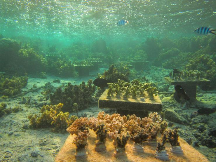
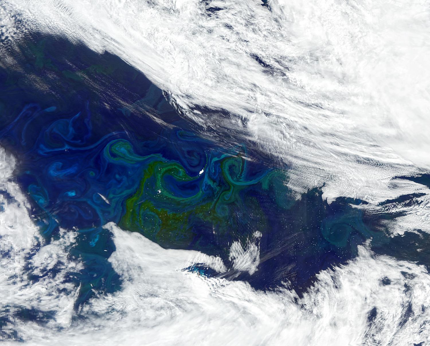
Ocean waters are getting greener at the poles and bluer toward the equator, according to an analysis of satellite data published in Science on June 19. The change reflects shifting concentrations of a green pigment called chlorophyll made by phytoplankton, photosynthetic marine organisms at the base of the ocean food chain. If the trend continues, marine food webs could be affected, with potential repercussions for global fisheries. 

“In the ocean, what we see based on satellite measurements is that the tropics and the subtropics are generally losing chlorophyll, whereas the polar regions — the high-latitude regions — are greening,” says first author Haipeng Zhao, a postdoctoral researcher at Georgia Tech working with Susan Lozier, dean of the College of Sciences and Betsy Middleton and John Sutherland Chair at Georgia Tech and Nicolas Cassar, the Lee Hill Snowdon Bass Chair at Duke University’s Nicholas School of the Environment.

Since the 1990s, many studies have documented enhanced greening on land, where global average leaf cover is increasing due to rising temperatures and other factors. But documenting photosynthesis across the ocean has been more difficult, according to the team. Although satellite images can provide data on chlorophyll production at the ocean’s surface, the picture is incomplete. 

The study analyzed satellite data collected from 2003 to 2022 by a NASA instrument that combs the entire Earth every two days, measuring light wavelength. The researchers were looking for changes in chlorophyll concentration, a proxy for phytoplankton biomass. For consistency, they focused on the open ocean and excluded data from coastal waters. 

“There are more suspended sediments in coastal waters, so optical properties are different than in the open ocean,” Zhao explains.  

The satellite data revealed broad trends in color, indicating that chlorophyll is decreasing in subtropical and tropical regions and increasing toward the poles. Building on that finding, the team examined how chlorophyll concentration is changing at specific latitudes. To work around background noise and gaps in data, they had to get creative. 

“We borrowed concepts from economics called the Lorenz curve and the Gini index, which together show how wealth is distributed in a society. So, we thought, let’s apply these to see whether the proportion of the ocean that holds the most chlorophyll has changed over time,” Cassar says.

They found similar but opposing trends in chlorophyll concentration over the two-decade period. Green areas became greener, particularly in the northern hemisphere, while blue regions got even bluer. 

“It’s like rich people getting richer and the poor getting poorer,” Zhao says.

Next, the team examined how the patterns they observed were affected by several variables, including sea surface temperature, wind speed, light availability and mixed layer depth — a measure that reflects mixing in the ocean’s top layer by wind, waves and surface currents. Warming seas correlated with changes in chlorophyll concentration, but the other variables showed no significant associations.

The authors cautioned that their findings cannot be attributed to climate change. 

“The study period was too short to rule out the influence of recurring climate phenomena such as El Niño,” Lozier says. “Having measurements for the next several decades will be important for determining influences beyond climate oscillations.” 

If poleward shifts in phytoplankton continue, however, they could affect the global carbon cycle. During photosynthesis, phytoplankton act like sponges, soaking up carbon dioxide from the atmosphere. When these organisms die and sink to the ocean bottom, carbon goes down with them. The location and depth of that stored carbon can influence climate warming.

“If carbon sinks deeper or in places where water doesn’t resurface for a long time, it stays stored much longer. In contrast, shallow carbon can return to the atmosphere more quickly, reducing the effect of phytoplankton on carbon storage,” Cassar says. 

Additionally, a persistent decline in phytoplankton in equatorial regions could alter fisheries that many low- and middle-income nations, such as those in the Pacific Islands, rely on for food and economic development — especially if that decline carries over to coastal regions, according to the authors.

“Phytoplankton are at the base of the marine food chain. If they are reduced, then the upper levels of the food chain could also be impacted, which could mean a potential redistribution of fisheries,” Cassar says. 


Funding: National Science Foundation and NASA.

Citation: “Greener green and bluer blue: Ocean poleward greening over the past two decades,” Zhao H., Manizza M., Lozier S.M. and Cassar N. Science, June 19, 2025, DOI: 10.1126/science.adr9715 

This story by Julie Leibach is shared with the Duke University Nicholas School of the Environment newsroom.


News Contact

Media Contacts:

Jess Hunt-Ralston
Director of Communications
College of Sciences 
Georgia Tech

Julie Leibach 
Senior Science Writer
Nicholas School of the Environment
Duke University